Neuseeland 03.03.-03.04.2017
mit Tagesaufenthalt in Hongkong am 02.04.2017
Unser erster Campingurlaub (Kanada 2013) war so beeindruckend, dass wir gesagt haben, so etwas machen wir noch einmal. Nachdem wir in Südafrika dann das Fahren im Linksverkehr geübt hatten, stand der Kombination von beidem nichts mehr im Wege. Wenn nur nicht die lange Anreise wäre...
Eines war von Anfang an klar: Wir werden nicht in der Holzklasse (Economy) fliegen, denn bei einer Flugzeit von ca. 24 Stunden macht das in der Enge der Sitzreihen wirklich keinen Spaß. Also sind wir, natürlich gegen einen entsprechenden Aufpreis, in der Premium Economy-Klasse geflogen. Diese bietet ca. 15 cm mehr Beinfreiheit und einige weitere Annehmlichkeiten, z.B. mehr Freigepäck.
Gebucht haben wir bei Lufthansa, die uns dann mit dem Star Alliance-Partner Air New Zealand bis ans Ziel gebracht haben:
- LH728 Frankfurt - Shanghai (Airbus A380-800)
- NZ288 Shanghai - Auckland (Boeing 787-900)
- NZ515 Auckland - Christchurch (Airbus A320) (separat gebucht)
- NZ87 Auckland - Hongkong (Boeing 777-200)
- LH797 Hongkong - Frankfurt (Airbus A380-800)
Unser Wohnmobil, ein Apollo Euro Deluxe, haben wir bereits in Deutschland
weit im voraus gebucht. Hier muss man sehr darauf achten, wann die jeweilige
Saison beginnt und endet, da jeder Tag früher oder später große Auswirkungen auf den Endpreis hat. Wir haben den Camper am ersten Tag der
Nebensaison übernommen, wie 60 weitere Mieter auch in Christchurch.
Gut, dass wir Frühaufsteher sind ...
Nun aber zu unserer Reise. Habt wie immer viel Spaß mit den Bildern und Infos.
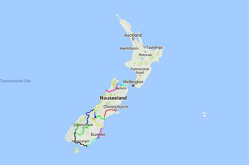
Unsere Routen in OpenStreetMap
- alle Fahrstrecken (ca. 5150 km)
Verwendete Software:
- OsmAnd (GPS-Aufzeichnung auf dem Smartphone)
- GPX Viewer (Track-Anzeige mit OpenStreet-Maps)
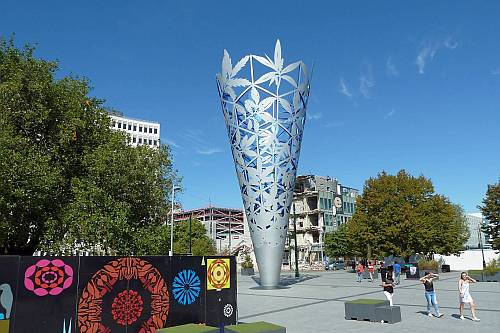
Christchurch
- Erdbeben von 2011
- Christchurch Cathedral und Cardboard Cathedral
- Mahnmal 185 empty white chairs in Gedenken an die Opfer
- Einkaufszentrum Re:START Mall
- Skulptur The Chalice
- Botanischer Garten
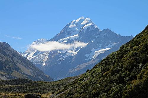
Mt Cook und Umgebung
Lake Ohau Lodge
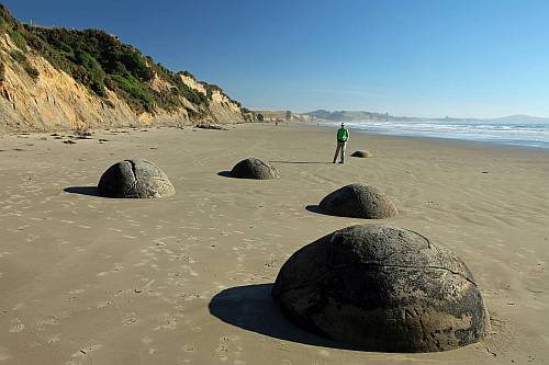
Oamaru - Dunedin - Otago Peninsula
- viktorianische Gebäude in Oamaru
- Moeraki Boulders
- Dunedin Railway Station
- Royal Albatross Centre, Otago Peninsula

Catlins
- Nugget Point mit seinem Leuchtturm
- Curio Bay mit Petrified Forest
- Hector-Delfin
- ungeliebte Possums
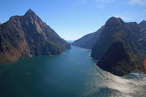
Milford Sound
- Anfahrt in den Sound durch den Homer Tunnel
- Key Summit Track
- Encounter Nature Cruise, Bootsfahrt am Mitre Peak vorbei
- Milford Discovery Centre & Underwater Observatory
- Milford Helicopters
- Mount Tutoko mit seinem Gletscher
- Sutherland Falls und Lake Quill
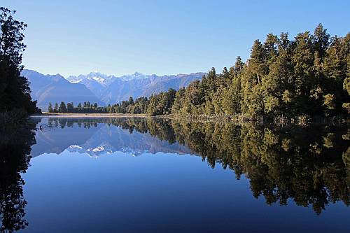
Wanaka und Westküste der Südinsel
- Wanaka
- Haast Pass
- Fox-Gletscher, Lake Matheson und Franz-Josef-Gletscher
- Hokitika
- Pancake Rocks
- Wekaralle (Laufvogel)
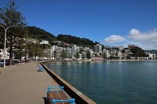
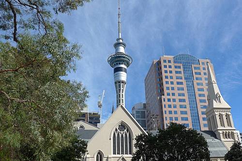
Cook Strait und Wellington
- Fährüberfahrt mit Interislander
- Museum Te Papa (freier Eintritt)
- leckeres Eis bei Kaffee Eis*
- Parlamentsgebäude Beehive
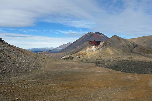
Tongariro National Park
- Tongariro Alpine Crossing
- Chateau Tongariro
- Wanderung zu den Taranaki Falls
Taupo - Waitomo - Otorohanga
- Trauerschwan
- Huka Falls bei Taupo
- Craters of the Moon
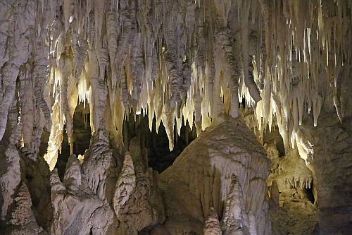
- Waitomo Glowworm Caves, Ruakuri Cave
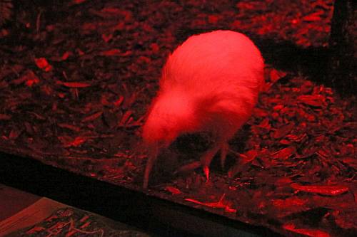
- Otorohanga Kiwi House
- Kiwi (Planet Wissen)
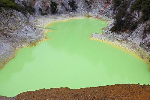
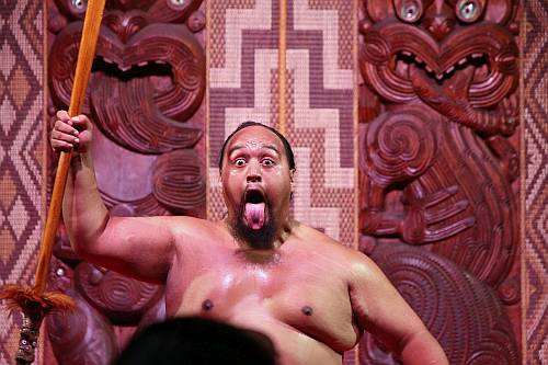
Rotorua und Coromandel
Northland
- Tawharanui Regional Park mit u.a. Takahe (Laufvogel)
- Kauri-Baum
- Hundertwassertoilette in Kawakawa
- Treaty House, in dem der Vertrag von Waitangi unterzeichnet wurde
- Riesendünen bei Omapere
- Muriwai Beach mit Tölpelkolonie
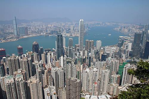
Hongkong
- Big Bus Hong Kong (Hop-on, Hop-off)
- Aberdeen Floating Village
- Peak Tram auf den Victoria Peak
- Star Ferry
- Maritime(s) Museum